La piena del fiume Misa del 16-17 novembre 2021
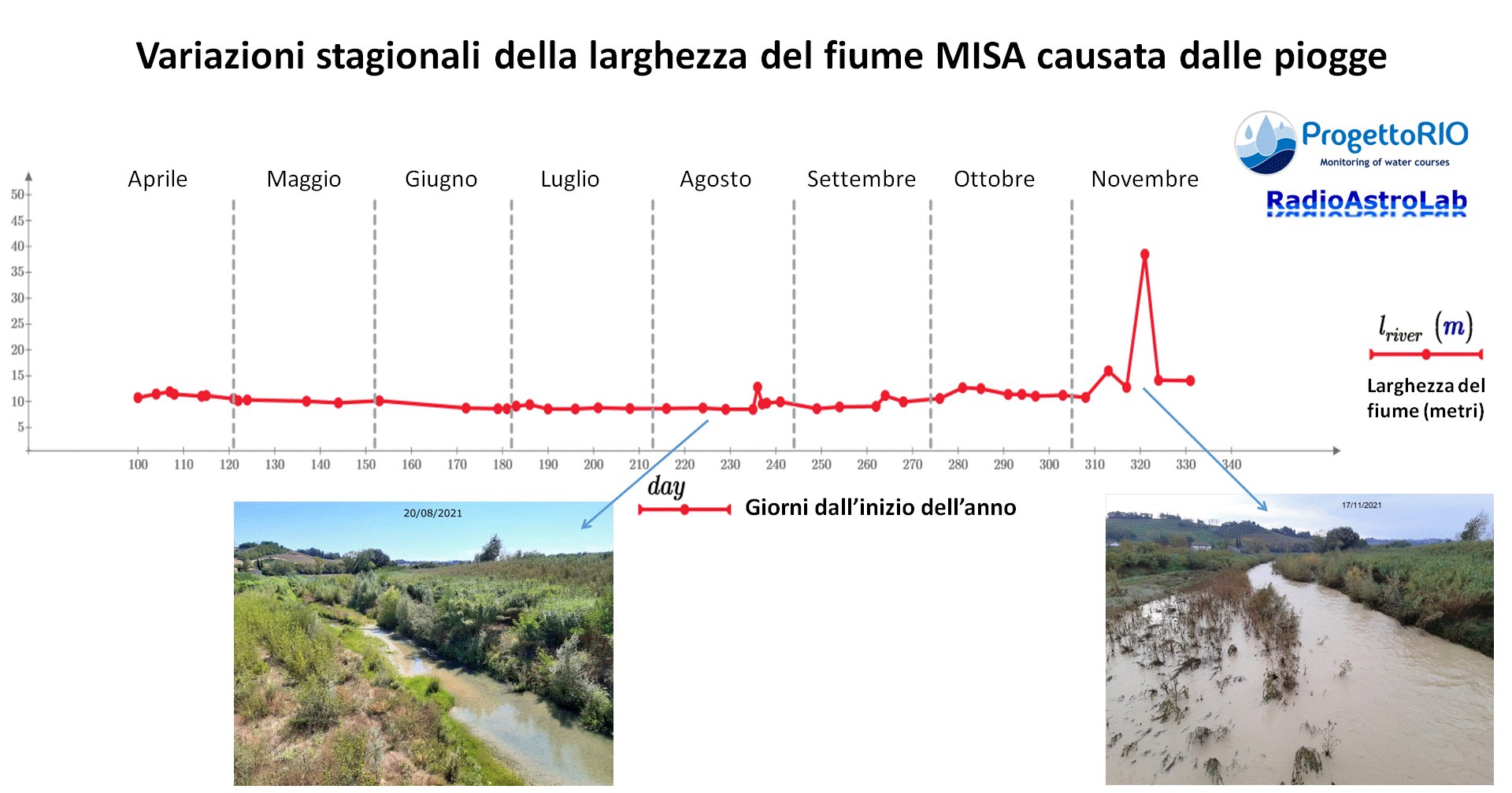
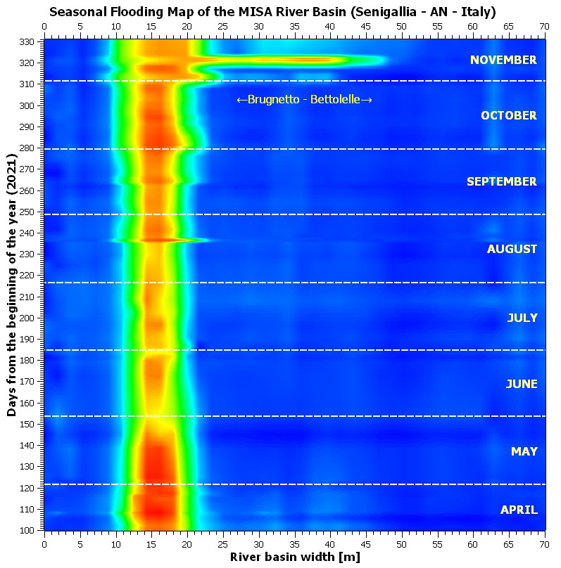
Il recente evento di piena del Misa (16-17 novembre 2021) è stato catturato dai nostri strumenti durante il monitoraggio del ProgettoRIO: il grafico e la mappa (in falsi colori) ci mostrano come varia stagionalmente la larghezza del fiume a causa delle piogge che insistono lungo il suo percorso. La mappa evidenzia il notevole incremento della sezione allagata del bacino fluviale il 17 novembre (rilievi fatti dal ponte che collega le località Brugnetto e Bettolelle): il colore rosso indica l’estensione della superficie bagnata di terreno.
The flood of the Misa River on November 16-17, 2021
The recent Misa flood event (16-17 November 2021) was captured by our instruments during the ProgettoRIO monitoring: the graph and map (in false colors) show us how the width of the river varies seasonally due to the rains that insist along its path. The map highlights the significant increase in the flooded section of the river basin on November 17 (surveys made from the bridge that connects Brugnetto and Bettolelle): the red color indicates the extent of the wet surface.


